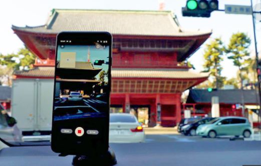
Google has announced that its latest Street View beta is available for users and it comes with a tool called connected photos. That allows users to capture and publish photos from an Android phone, without a 360-degree camera. To get the imagery started, you’ll need to record a series of photos as you go down a street or path.
“After you record your images and publish them via the Street View app, we automatically rotate, position, and create a series of connected photos,” the company wrote. “We then place those connected images in the right place on Google Maps, so your new Street View can be found in the exact location where it was taken for others to see and explore.”

They’re captured using ARCore, the same tech used by Google for Live View AR experiences. Google photos will show on the map as dotted blue lines, which you locate by dragging around the Pegman.
“Where we have existing Google Street View imagery, we’ll show that as the primary Street View experience with a solid blue line,” Google adds.
Now your street View photos could be seen by many other Maps users. This feature is only available in places like Toronto, New York City, and Austin, TX, along with Nigeria Indonesia, and Costa Rica, with more regions on the way soon.
TECH NEWS>>>>Google Is Closing Its 3D Model Sharing Service “Poly”


